Tuesday, 14 June 2016

     A Trip To Nandi Hills 


So first I will tell you guyz what is this place all about,  
And here you go.....Nandi Hills is a place which is as beautiful as heaven(I think calling it like heaven will be justifying when u guyz will visit the place ). There are many stories about the origin of the name Nandi Hills. During the Chola period, Once upon a time Nandi Hills was called Ananda Giri meaning The Hill of Happiness. Another story is that Yogi Nandeeshwara performed penance here, and so it was named after him. A temple of Yogi Nandeeshwara is situated on top of the hill. Nandi is also commonly called Nandidurga Fort because of the fort build here by the ruler Tippu Sultan. It is also perhaps called Nandi Hills because the hill resembles a sleeping bull Nandi. There is a point called Tipu drop and guess what why it has been calling by that name.....well i am not going to tell :P, Go there and find by yourself :D


Morning vie of Nandi Hills

Perched at a height of 4,851 feet above sea level, Nandi Hills, a little over an hour’s drive from Bangalore, is an idyllic escape. The former summer retreat of Tipu Sultan, this ancient hill fortress is scattered with monuments and shrines and is a pleasant change from the humdrum of city life. Nandi Hills has been a favorite picnic place for young enthusiasts on a weekend.  The pleasant climate appeals to the old and the young alike. Lovers and honey mooners, in search of a quiet, beautiful place, and families on economised budget prefer Nandi 
Hills. Historians can find a wealth of information and the spiritual minded, peace and tranquility.


Entry gate for Nandi hills peak and fortress

Best part of nandi hills is you can go there in any month, you don't have to wait for any appropriate seasson. Climate of Nandi hills remains always same. But I must tell you timing matters alot. Best time for Nandi hills is morning because nothing can be more beautyful then the view of Sunrise from the top. Clouds will be touching your feet and the view of other peaks will be mesmerising.

Sunrise view
Important Note :
Be aware of monkies as they can snatch your icecream :P , because you cann't resist icecream at the peak of nandi hill.


For those people who love cycling this is best destination near Bangalore.  And riders even you people don't worry this is best even for riding that too in morning roads completely covered by fog.


How to reach Nandi Hills :


Basically it's a 1 day trip. Grab a cab from bangaluru, It will take around 2 hours to reach from any part of the city,just make sure you start your journey by 5 O'clock. 

Have your breakfast at the foot of Nandi hills with amazingly made filtered coffee.So guyz steal your 1 day from your busy schedule for yourself  and enjoy your trip to Nandi hills with icecream :P

Keep Riding..


Friday, 22 April 2016


World's Most Dangerous Roads between Kishtwar (Jammu & Kashmir) and Killar (Himachal Pradesh)


Mughal Road 


The road is 84km long between Bafliaz, a town in the Poonch district of Jammu & Kashmir to Shopian district in the Jammu & Kashmir. The road was historically used by Moghul emperors to travel and conquer Kashmir during the sixteenth century. It was the route used by Akbar the Great to conquer Kashmir in 1586, and his son Emperor Jahangir died while returning from Kashmir on this road near Rajouri. It passes over Pir Panjal Mountain range, at altitude of 11,500 ft. Pir ki Gali is the Highest Point on this road. (Pir Ki Gali). Apart from this it is an alternative road for travelling to Srinagar.


Sinthan Top

Sinthan Pass: The Sinthan pass connects Kashmir valley with Kistwar Valley. It is located at 12,500 ft and is snow-capped for most of the year. It is located on Srinagar – Anantnag – Kokernag - Kishtwar Highway.


Peer Ki Gali

Pir ki Gali is the Highest Point on this road at an altitude of 11,500 ft.


Worlds Most Dangerous Road

World’s Most Dangerous Road between Kishtwar (Jammu & Kashmir) and Killar (Himachal Pradesh). The road is so narrow that only one vehicle can pass at a time with numerous steep inclines and declines. This road gives access into Pangi Valley of Himachal Pradesh. The road is full of rocks, loose soil, etc, on one side there is 1000 feet freefall into the river Chandrabhaga and deadly mountain cliff hanging on other. The road condition is never constant, it sees many landslides. One mistake and it can turn out to be disaster. This road is featured into many travel forums as “One of the most Dangerous Roads in the World”. (Tyar to Sansari)

Chandra Taal

Chandrataal Lake: Chandra Taal (Lake of the Moon), is situated at an altitude of about 14,100 ft in the Himalayas. Mountains overlook the lake on one side, and a magnificent cirque presents a view on the other. It is motorable from Batal which is 14km away from Chandrataal in the state of Himachal Pradesh.


Kunzum Pass

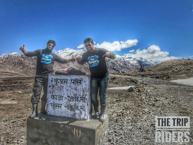
Kunzum Pass / Top. A high mountain pass located at an altitude of 15,060 ft on Eastern Kunzum Range of Himalayas in the state of Himachal Pradesh. Kunzum Pass connects Lahaul Valley with Spiti Valley in Himchal Pradesh.

Komic

Komic, also known as the Highest Motorable Village in Asia located at an altitude of 14800 ft in Kaza District of Himachal Pradesh.

Kishtwar

World’s Most Dangerous Road between Kishtwar (Jammu & Kashmir) and Killar (Himachal Pradesh). The road is so narrow that only one vehicle can pass at a time with numerous steep inclines and declines. This road gives access into Pangi Valley of Himachal Pradesh. The road is full of rocks, loose soil, etc, on one side there is 1000 feet freefall into the river Chenab and deadly mountain cliff hanging on other. The road condition is never constant, it sees many landslides. One mistake and it can turn out to be disaster. This road is featured into many travel forums as “One of the most Dangerous Roads in the World”. (Tyar to Sansari)


Killar

World’s Most Dangerous Road between Kishtwar (Jammu & Kashmir) and Killar (Himachal Pradesh). The road is so narrow that only one vehicle can pass at a time with numerous steep inclines and declines. This road gives access into Pangi Valley of Himachal Pradesh. The road is full of rocks, loose soil, etc, on one side there is 1000 feet freefall into the river Chenab and deadly mountain cliff hanging on other. The road condition is never constant, it sees many landslides. One mistake and it can turn out to be disaster. This road is featured into many travel forums as “One of the most Dangerous Roads in the World”. (Tyar to Sansari) World’s Most Dangerous Road between Khillar (Himachal Pradesh) and Keylong (Himchal Pradesh). This road connects Pangi Valley with Lahaul Valley in Himachal Pradesh. There are numerous steep inclines and declines. On one side there is 1000 feet freefall into the river Chenab and deadly mountain cliff hanging on other. The road condition is never constant, it sees many landslides. This road is featured into many travel forums as “One of the most Dangerous Roads in the World”


Udaipur

World’s Most Dangerous Road between Khillar (Himachal Pradesh) and Keylong (Himchal Pradesh). This road connects Pangi Valley with Lahaul Valley in Himachal Pradesh. There are numerous steep inclines and declines. On one side there is 1000 feet freefall into the river Chenab and deadly mountain cliff hanging on other. The road condition is never constant, it sees many landslides. This road is featured into many travel forums as “One of the most Dangerous Roads in the World”


Tuesday, 2 February 2016

THE TRIP RIDERS LADHAKH MOTORCYCLE EXPEDTION 2K16


                 THE TRIP RIDERS LADHAKH  MOTORCYCLE EXPEDTION 2K16


        Ride To the land high passes


WHO WE ARE :-

The Trip Riders(P) LTD. is one of India's better known adventure tour operator, that specializes in adventure travel in the Indian Himalayas. Offering personalized itineraries  and  routes  you'd  be  hard  pressed  to  find  a more experienced, fun loving, safety conscious tour operator in India .If you've dream of a particular journey or an adventure in India, let us know. We'll make it happen. No matter how bizarre or wild or difficult.

Our team competitive monitors our range of tourism related industry to confirm that we offer the highest quality and most competitive product.


The Trip Riders team discovers, explores, meets people and brings out information on trekking trails in India. By information – we  mean  detailed  information  about  the trek – with maps, photographs and useful contacts. Wherever possible we bring you videos and audio experiences of people as they are hiking on a trail. Even with powerful search engines like Google information on trekking trails in our country is difficult to get. Apart from a handful of well-known treks – most trekking trails are unknown in our country.

Expedition Overview : 

In this tour of The Trip Riders, you will explore & experience the highest motorable road of 5,600 mtrs, visiting ancient Buddhist monasteries, Visiting Tibetan nomads with their caravan of Yaks and Pashmina goats on a Legendary Royal Enfield in Mountain Motorbike Tour. If you are a true thrill & adventure loving Motorcyclist enthusiastic & planning for Mountain Motorcycle ride with Highest Mountains Range then this Tour is the perfect for you. This Motorcycle Tour to Ladakh is highly recommended for every Motorcycle Rider at least once in a Life & adventurous moment of this Tour will remain forever in your memory which you never had so far, so come and experience the Land, where Sky & Earth Meet with THE TRIP RIDERS.. !!
Because bike ride to Leh, Ladakh passes through some of the most breathtaking, challenging and awe-inspiring landscapes found on Earth. But by any means it is not an easy ride since most parts of the road are at altitudes of 13,000 feet and above in the Himalayas. In addition, the number of miles one can cover in a day depends on the road and weather conditions .Our Signature motorbike tour is specially designed for people who want to see the beauty of Leh – Ladakh.  


Motorcycle checkup for Expedition:
Now that you have prepared your motorcycle for Ladakh Motorcycle Expedition 2k16, and are ready to start your ride Delhi, there are a few checks you need to perform before the D-DAY….!!!
  • Check if all lights, horn and indicators are working.
  • Double check fluid levels such as engine oil, brake oil and coolant (in case of liquid cooled motorcycles).
  • Check tyres for air pressure as well as look for any signs of puncture or damage.
  • Check if chain is lubricated properly and isn’t too tight or too loose.
  • Check for any leakages.


                                                        Detailed Itinerary

Day1:- Delhi to Jammu (577 kms)
Early morning wakeup call for the meeting point. Later, we flag off our epic expedition starts from Delhi to Jammu ride, a distance of about 577 kms. En-route we cross Ambala, Jalandhar and later drive through to Pathankot and reach to Jammu in late evening. 
During our ride, we stopover at for breakfast in kurukshetra and lunch in Jalandhar. After dinner, overnight stay in Jammu in a hotel. 

Day2:- Jammu to Srinagar (294 kms)
We leave Jammu after breakfast. The 294kms stretch to Srinagar takes approximately 11-12 hours. We will enjoy a tea break at Patnitop and lunch in Banihal. After, a full day ride we reach Srinagar. After dinner, overnight stay would be in a hotel.

Day3:- Sringar to Kargil via Zoji La Pass (210 kms)
Today we start the ride which you will remember for the rest of your life. We take it easy this day and ride on various terrain which we would encounter later on in tour. We reach Sonmarg by lunch - time, enjoying the alpine landscape and snow­capped peaks. After lunch, move towards kargil via Zoji La Pass. The first real test of the ride. Zoji La pass at 11,575 feet overlooks the beautiful mountains of Sonmarg on one side and the high altitude Ladakh region on the other. The constant landslides at the pass mean that we ride through slush and broken roads before we can set eyes on the brown landscape awaiting ahead.

The historic road from Drass to Kargil is a delight to ride on, with majestic views, green villages and raging rivers alongside. After dinner, Overnight stay would be in hotel.                                                                
 Day4:- Kargil to leh via Lamayuru(225 kms)
After breakfast we head towards Leh. We ride downstream along the River Indus on Leh – Kargil Highway. The striking rock sculpture of the Maitreya Buddha greets you at Mulbek soon after you depart from Kargil. Then you cross over two very beautiful passes, Namika La and Fotu La, before reaching the unique moonscape of Lamayuru. 

After spending some time at Lamayuru monastery, we continue the journey ahead to Leh. You will also visit Gurudwara Pathar Sahib, a beautiful Gurudwara constructed in the memory of Guru Nanak. After Dinner, overnight stay would be in hotel.

Day5:- Leh Acclimatization,  Local sightseeing
Today, you are on our own. It’s time for us to get acclimatized to the thin air, followed by an entire day at leisure in the capital city of Leh. You take a breather from the ride and rest at Leh. After a half day's rest you explore various parts of Leh, such as the local market, leh palace, monasteries and the Shanti Stupa.


Day6:- leh to Nubra Valley via Khardung la Pass (142 kms)
An early morning wake up, followed by Breakfast and checking our bikes and gear, we start our drive towards Nubra valley Via the world’s highest motorbale road- KhardunglaPass (5602 mts). After lunch, visit the main Diskit Monastery and the giant statue of Maitreya Buddha, this is the tallest Buddha statue in Ladakh. Later visit the white sand dunes at Hunder where you can enjoy the Double Humped Bactrian camel ride. The rest of the evening is free for leisure activities. Overnight stay would be in Guest house Diskit or Hunder. 

Day7- Nubra valley to Pangong Tso via Wari la Pass (230 kms)
Early wakeup call, after breakfast we will start our journey to the world’s highest salt lake (14272 ft.). 

Best Route of this Expedition 

The below route near to Wari La involves good amount of off roading with almost no road and a lot of water streams on the way. I am sure, any motorcycle rider will love this route. It is amongst my favorite trails in Ladakh as there are very less people, almost zero tourists, not at all developed, no roads, less Dhabas, no BSNL signals, no shops, no villages. Only you with some wild mules, horses, yaks, sheeps and a few distinct birds of Ladakh and the adhoc mountains with blue sky in background and cold water streams under you on the path or trail leading to Wari La.

Nubra Valley -Agham - Wari La - Sakti - Chang La - Durbuk - Tangste - Pangong tso

After today's hard core off road biking. Overnight stay be in camps at Pangong Tso lake.

Day8- Rest day at Pangong Tso for Photography 
Enjoy the beautiful panoramic view of lake. Situated at an altitude of 4,350 meters above sea level, Pangong Lake lies in the northeast of Leh. This famous blue blackish lake. Enjoy the landscape in the back drop of the Lake. This famous blue brackish Lake of Pangong is 5/6 Kms wide and over 144 Kms long with half of its running the other side of the "INDO CHINA BORDER". One rarely feels so close to nature and environment and the scenery is unforgettable.

Evenings are at leisure, followed by a grand theme celebration and dinner at Pangong Lake. Overnight stay in camps.  

Day9- Pangong lake to Leh (Rafting day) (150kms) 
This morning, after breakfast proceed for back to LEH. After lunch we move towards river rafting. Bonefire at night followed by Dinner. Overnight stay at hotel in LEH. 

Day10- Leh to Tso Moriri via Chumathang (240kms) 
Post Breakfast, we do a complete gear check and drive to Tso Moriri Lake. It is a breathtaking journey on a trail that is literally a ‘no man’s’ land.
Tso Moriri Lake has no outlet and the waters are consequently brackish, although not very perceptible to the taste. The water is crystal clear and of a deep blue color. This Day will cover Thicksey, Hemis and Shey monasteries while going through this route. Overnight stay at hotel.


Day11- Tso Moriri to Jispa(317kms) 
An early wake up call, followed by a stroll around and Breakfast, we start our ride back to Manali with our 1st overnight hault at Jispa. Jispa, in Himachal Pradesh lies at 3319 m (10,890 feet) on the bank of the Bhaga River, whose waters lull you to sleep at night. Mudhouses and Buddhist chortens complement the serene cape.
As the sun descends, the evening welcomes you to the warmth of the campfire. Overnight at the hotel.

Tso Moriri (Karzok) – Sumdo – Tso Kar (105kms)
Tso Kar Lake - Jispa (212 Kms)


Day12- Jispa to Manali via keylong (137kms) 
We start our day early and our ride from Jispa to Manali. The route is slightly rough, so this day we shall try and cover the maximum distance with minimum stopovers. We arrive in Manali by the evening. Over Night stay in a hotel.

Day13- Expedtion farewell party in Manali and Paragliding day
Enjoy the lazy morning in Manali. Before lunch do Paragliding in Solang valley. In Evening, we celebrate farewell party of The Trip Riders Ladakh Motorcycle Expedetion 2K16. 

Overnight stay in hotel.

Day14- Manali to Shimla (240kms) 
This is the final leg of our ritual road trip. We will leave Manali in the morning after Breakfast. We will take the road towards Shimla from here, via Sundernagar, Kullu valley & Mandi. By evening we will reach Shimla. Enjoy your evening on Mall Road Shimla. After dinner overnight stay in hotel. 

Day15- Shimla to Delhi (360kms) 
This is the last day of our ride. Post breakfast we start are journey back to Delhi. 

Package Inclusions: -

  • Accommodation in well appointed 3 star or equivalent hotels on Twin sharing Basis.
  • Inner Line Permits and Wildlife fees for restricted areas for Indian Nationals.
  • Petrol throughout the expedition. 
  • Basic First Aid Kit & medicines
  • Services of a Royal Enfield trained specialist mechanic for the full duration of the trip.
  • Theme Dinner Celebrations at Pangong Lake.
  • Use of equipment and the services of trained guides and professional.
  • Dedicated trip leader, certified in First Aid and CPR from NOLS, USA throughout the trip.
  • Back up Utility Vehicle including luggage transfers.


Package Exclusions: -

  • Any expenses incurred due to Force Majeure
  • Any Travel expenses from Delhi.
  • Personal expenses like Telephone, Laundry, Tips and Table Drinks etc.
  • Any item not mentioned in the inclusions

Other TERMS AND CONDITIONS: -

  • 100% Payment in advance.
  • The program schedule, route, or mode of transport might be changed due to unforeseen circumstances or for the safety of the group.
  • In case any participant falls sick during the tour, the expenses for medical treatment, travel & porter charges etc. will be borne by the concerned individual.
  • During the tour, the decision of the Program Director and/ or the Field director will be final and binding.
  • The Trip Riders shall not be held responsible for any accident, illness and loss of valuables or such other unforeseen events during the tour.

Expedition Pricing:- 

COST PROPOSAL FOR 15 DAYS 14 NIGHTS WITHOUT MOTORCYCLE - 35,000/-PER PERSON 

COST PROPOSAL FOR 15 DAYS 14 NIGHTS WITH 500cc Royal Enfield - 50,000/-PER PERSON 

All Taxes are included. 

For Reservation:-
Call us on +91 8860832239, 9999028311
Write us on akashvats12@gmail.com for any query 


  Happy Riding....!!!


Monday, 1 February 2016

Spiti Valley "The Middle Land" Expedition

One more addition in our Trip Diary


Well generally I start sharing my experience with a very gentle introduction but for Spiti Valley I can't resist myself saying that Hell yes I got the place I was searching for last so many years, full of adventures in the lap of Himalayan mountains you gonna see unbelievable scenarios of mother nature. It is situated in Himachal Pradesh. Spiti valley is known for majestic climate and scenic places around it.
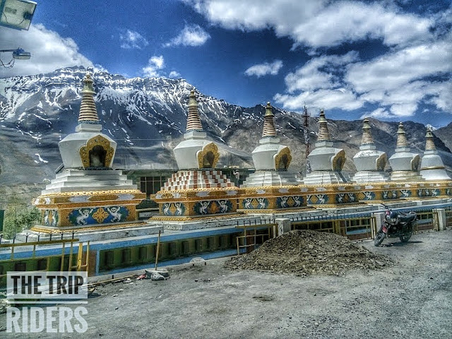
The Land Between Tibet And Ladakh Is The Off Beat Tourism Destination In Himalayas. For Centuries People In These Remote Valleys Lived Largely Isolated From One Another, Holding And Preserving the Treasures And Secrets Of Ancient Civilizations Untainted By Modernity Unmatched Outside These Mountains. Spiti valley is a research and cultural center for Buddhism. There are about 30 big and small monasteries spread over the Spiti valley. The most famous of all are the mystical Kee monastery at Kaza (which is the biggest monastery), precariously perched atop a craggy cliff- Dhankar monastery, the frescoes and stucco statues of Tabo monastery (which is the oldest monastery in the whole Himalayas – 1012 years old), Kungri monastery (in the Pin valley). Most common wild animals found here are – Yak , the largest animal found in Himalayas, Bharal – known as the Himalayan blue sheep, snow ibex, Himalayan golden eagle and the Snow leopard which is found at a height of above 5,000 metres. 


"But if compared to Ladakh, Spiti valley is still very harsh and desolate. It takes a certain amount of madness to drive on these uninviting, mesmerizing landscapes. And to do it solo – you need to be more than just mad. When I decided to drive solo, through this unfamiliar terrain of East Himachal – home to one of the ‘world’s deadliest roads’ – my sole intention was to see its natural vistas and being careful of every step."

Spiti is accessible by road round the year and requires you to travel a total distance of 700 to 800 kms, depending upon what all places you want to visit on the way. I travelled from Delhi to Shimla to Kaza to Delhi . You can also complete the journey the other way round– by starting from Manali, and following the tribal circuit, until you reach Shimla. But personally, I’d advise you to start from Shimla for a couple of reasons. First, if you start from Shimla, it would be easy for you to acclimatize to high altitude without a sudden discharge. Second, this way you won’t need to obtain a permit to cross Rohtang Pass, which you otherwise do if you initiate the journey from Manali. Obtaining the permit means spending extra money and killing one or two days in the DC’s office, in Manali

Day 1: Noida to Shimla (8 Hours; 394 Kms): 

We started our journey from Noida with 2 bikes Desert Strom and Thunderbird, We headed towards Amrik Sukhdev Dhaba for our lunch which is in Murthal and trust me starting your journey from there is as good as it's lassi and parathas , after having hell lot of parathas we started our journey for Shimla. It was a bit stormy day so we started very slowly and in 5 hours we were in beautiful valleys of Shimla. We had a very tight sleep that night and know first day is always tiery :D.


Day 2: Local Sightseeing Day in Shimla : 

We enjoyed the lazy morning at shimla. Nothing can be more beautiful then the morning scenery of Himalayas. We started our day with Tea and Paratha's and a carnival was there on the Mall Road. So we joined the carnival and had some local dishes over there then we had some sight seen in Shimla and finally at night we had a house party with our local friends :D


Day 3: Shimla to Reckong peo(8 hours; 248 kms):


This day was the starting of our adventure side. Our targeted destination was Reckong peo roads were hell awesome and hospitality of local people was mind blowing, our first stop was Narkanda (64KMs from Shimla). We got some problems in our bike chains so we decided to check it in Narkanda. After that we lead towards Rampur and now we needed to be refueled ourselves. So we had fresh sugarcane juice and then we headed for Reckong Peo. It was a memorable moment for us when we saw the starting point of kinnaur district. No one can describe the beauty of that scenery in words, it was just flow-less. And after a long day ride we reached Reckong Peo. We were nicely welcomed over there.
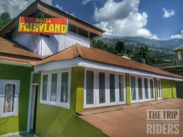
Weather was damn awesome and the best part was when local people of Peo asked us that "guys will you people go back from here, we replied no we will go to kaza and they were literally shocked and said you will find nothing in kaza even we don't go there :P. And our reaction was like ohk ohk frnds see u then a big bbyeeeee. We stayed in a hotel named (farryland). It was cheap and best. Food was Delicious. 


Day 4: Reckong peo to Tabo (7 hours; 158 kms):

We woke up slightly late in the morning. After got ready we saw some dhabas near bus stand for breakfast. Our 4th day target was Kaza but we already late. We refueled our bikes with petrol in Reckong peo. Just after Peo next 25 kms was like mind blowing. Roads were too narrow and full of stones towards Spillow. Our best experience started from here and trust me that was the starting of all the thrills. We clicked some nice pics there in between so many amazing places like Spillow and Pooh. In Pooh we met Indian Army soldiers of Bihar regiment. Road after Pooh to Nako was amazing and the best part was Satluj river following the route side by side. The Road was incredible awesome when the kah loops starts from the Bridge. After 6 hours ride we reached Nako. We met local people of Nako and they were very nice and gentle.  After a 1 hours break we headed towards Tabo. We Stuck in a double landslide between Nako and Sumdo in Spiti, Rocks boulders all rocketing down. And yes the most Important thing Mobile network is not available after Rekong Peo except BSNL , So carry a BSNL sim with u. After 4 hour ride we reached Tabo. We went to Tabo Monastry which is very beautiful and has very deep and huge history with it. There we stayed in a mud house and it was a nice experience. We met here a lawyer from noida is travelling solo from 25 days in Spiti from local transport.  We had dinner and again time for a tight sleep.


"The Tabo Gompa, or Buddhist monastery, is second in importance only to the Tholing Gompa in Tibet in the entire Himalayan region. It was developed as an advanced centre for learning by the great teacher and translator Lotsawa Rinchen Tsang Po, the king of western Himalayan Kingdom of Guge -- also known as Lha Lama Yeshe O'd or Mahaguru Ratnabhadra. The Chos-Khor at Tabo remained one of the most important Buddhist establishments during the time of Lotsawa after the Chos-Khor at Tholing, the capital town of Guge. It is known that the Chos-Khor at Tabo commanded great importance, and hosted for a considerable period, many great scholars and translators in the Buddhist history studies. To date, it is the preserver of the Buddhist Legacy and is one of the most important Gompa of the entire Tibetan Buddhist world.

Day 5: Tabo to Kaza ~Excited Mode Activated~(3 hours; 54 kms):


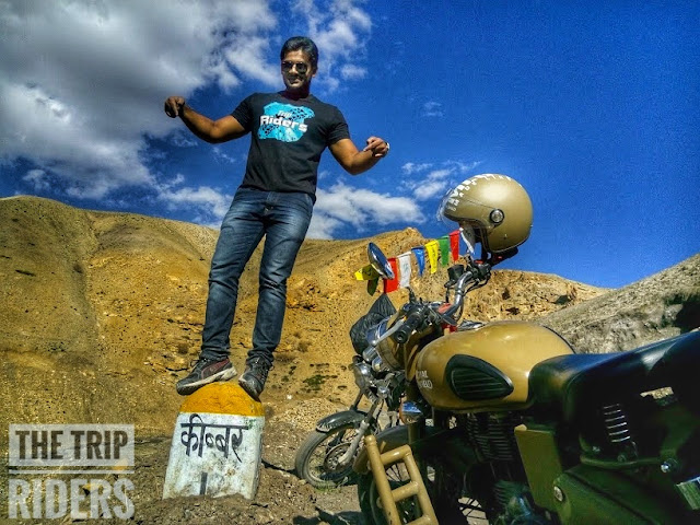
Woke-up early this morning and had a very delicious breakfast in monastery.  So this day we were so much exited because our target was kaza :D. and we got a straight road which was very close to river and it was so fascinating for us. We reached kaza after 3-4 hrs ride and our motorcycles needed some primary checkup , we stayed in Hotel Deyzor and at that time it was like feather in a crown. We just threw our bags there and rushed for Key Monastery and trust me that excitement was completely worthy, View was breathtaking and Key Monastery was looking so beautiful. The spectacular monastery is located at an height of 4116m and 7 km from Kaza. It is the largest monastery in Spiti Valley and established in the 11th century has ancient Buddhist scrolls and paintings. It also has houses large number of Buddhist monks and a cafeteria. I guess this much detail will be enough for now. From Key we went to Kibber.


"KIBBER village is located at an height of 4205m and 18 km from Kaza and is believed to be highest motorable village in the world. The village is known for its scenic landscape and numerous Buddhist Monasteries. Situated at an elevation of 4850m, Kibber is resembles to the villages of Ladakh and Tibet.According to 2011 census, there are 77 houses in the village and about 187 men and 179 women reside here".

I read about Chandratal lake (d lake of moon) a few years back, and from that moment on it’s always been on top in my bucket list. Nothing can be more soothing and rewarding than admiring the bounties of nature and that too by doing a trek to a place which is still unaffected by the ever-increasing endeavors of human beings.


We want to do Chandratal lake too but that time road was not accessible from KUNZUM PASS so it was a very bad feeling for us but we can't miss this moment. So we decided to submit Chandertal Lake trek. From Tashi Zom Guest House we got a phone number for our Chandratal trek guide. We stayed in Kibber  for 2-3 hrs, played Gali-cricket with kids. It was worth spending time in Kibber. We headed back to kaza and met Jamaica(the guy whose number we got in Tashi Zom Guest House Kibber). He suggested us to acclimatize first then start trek for Chandratal Lake. Suddenly 3 trekkers came from the same trek but they was not submitted Chandertal lake :D. For a moment we feel very bad for them but now its our turn to submit Chandertal Lake. After getting some information from those Guyz we left for Kaza market to purchase some packed food and gum boots because its a snow trek so we can't take any risk while trek. 

In Evening, we back to the hotel with some party stuff because we planned a small party time for ourselves, u know what i mean :P. Deyzor is best hotel in kaza, for sure.Amazingly done feels just like home. Small small things like quotes on table, walls. Various Deco items. No words to describe. Thoroughly enjoyed the stay. Karan Singh Bedi, you are an inspiration to many and kudos to you for creating this little heaven!. After enjoyed delicious food we gone sleep.

Day 6: Kaza to Komic to Losar (4 hours; 120kms )

After getting ready in morning, we planned to visit Komic village the highest village in ASIA and highest post office in WORLD. We were excited to see all those places. A monastery was there and lama was very friendly, they offered us food and tea. We were so happy because we din had breakfast and thought we will get maggi in comic bt no shop was open there. so we had our lunch there. And we spent some quality time with lamas. Place was so beautiful, all peaks were right in front of our eyes and small beautiful houses like patches in velvet. After spending 2/3 hours in komic, we leave for kaza because we have to reach Losar by evening. 


Jamaica arranged all essential things for us with a local guide. That guide(Dorzy) arranged our night stay in his own house. There was mind blowing curves in the way. View was mesmerizing , we got some straight roads also :D. Deserted mountains caped with snow was looking amazing. We also got some water logging on the roads. We reached Losar in 3 hours ride. We got a warm welcome from Dorzy's family. And the traditional drink (PIYO) and dinner (TECHA) was waiting for us. After having dinner we gone sleep. 


Day 6: Losar to Kunzum Pass to Chadertal lake (10 hours; 30kms)

We geared up for Kunzum pass and our ultimate destination Chandratal lake. And i can't describe the beauty of the roads while going there, full of water logging :P, view was breath taking. Finally we reached Kunzum pass situated at 4,551 m above mean sea level, Kunzum La or Kunzum Pass is one of the gateways to Lahaul and Spiti valleys. It is one of India’s highest motorable mountain passes situated in Himachal Pradesh. Spiti and Lahaul valleys has been separated, it is situated at a higher altitude than Rohtang Pass, which is at an elevation of 13,054 ft and also serves as another gateway to Lahaul and Spiti.


Popular with tourists visiting Lahaul, Spiti and Manali, Kunzum Pass offers spectacular views of Bara-Sigri, the second longest glacier in the world.  Also visible from the top of the pass are the Chandra-Bhaga mountain and Spiti valley. The presence of chortens and prayer flags signify a strong Buddhist influence in the area.
Also popular, is the Kunzum Devi Temple where all vehicles must stop to pay respects to the goddess. After finishing our prayer we parked our bikes beside the temple and started treking towards Chandratal lake. Trust me it was life time experience for me, walking on glaciers was breath taking.


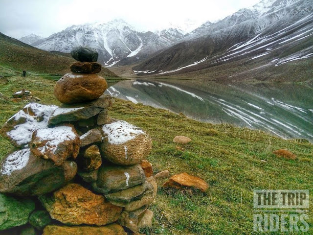
The scenic view was amazing. We felt like only we four left on this earth, so quite, completely isolated. After 3 hours of continuous but very slow walk we stopped for rest and we all were damn badly hungry ;). We got some boiled egg and boiled potato with us and i wont forget that 1 inch thick bread :P . Again we started our trek. I can't elaborate my experience of trek in words for that even you people should also do it once. We completed our trek in 6 hours. And the moment when we saw Chandartal lake first time we understood why it is called Lake of Moon. It was so beautiful with crystal clear water, Now i will introduce Chandratal lake :P

"Chandratal, located in the Lahaul and Spiti district of Himachal Pradesh, is a 2.5-km wide fresh water lake. At a height of around 14100 feet above sea level, the lake is surrounded by scree, and brown mountains, which in the winter season turn white. The huge cirque here offers a magnificent view of the lake and far off snow-clad peaks of the Himalayan Mountain Range; thus, making it a paradise for photographers."

"As its shape is more like a crescent, hence called “Chandra” while the word “Tal” stands for a lake. The Anglicized version of this Himalayan splendor is Moon Lake."

What was its past?


There are many stories related to Chandratal, one of which says that it was a resting point for traders heading towards Spiti and Kullu Valleys. According to another legend from the epic Mahabharata, it is the same location from where Yudhishthira, the eldest of the Pandava brothers, was taken to Swarga (heaven) by Lord Indra. As a result, the lake is also visited by a number of devotees. The most interesting part is that the locals believe it to be blessed, and visited by fairies at night.

We arranged our camp just beside the lake. And in the mean time snow fall started. you know I can undoubtedly say that it was gateway of heaven. We forgot our tiredness when we saw our surrounding. I bet no one can forget that scenic view. We eat maggie made by Dorje and take some rest in our tent. After took some pictures we get back to the tents. After dinner we opened our sleeping bags and start fighting with cold. It was a different experience for us on such altitude. One thing more that forget to mention "We are first trekkers of 2015 who submit Chadertal Lake". 

Day 7: Chadertal Lake to Losar (9 hours; 30kms)

We woke-up at 5 am in the morning. We find that our tent is covered with snow. The lake was covered with white snowy mountains. we walked slowly, eager to catch the first glimpse of the lake. There it was, cradled in the lap of the mountains – dazzling blue and unreal. Prayer-flags fluttered in the strong wind. For a while I just stood mesmerized at the sight. It was such a pure turquoise. I looked up at the sky. After took some pictures we headed back to Kunzum pass where we parked our bikes. 


Suddenly snow fall started, we moved quickly as we know that "bad weather can be worse anytime ". 
  
After reaching Kunzum Passs we had tea break over there and moved towards Losar.
We are very happy that we submit Chandertal lake trek. We reached Losar on the same home-stay where we stayed before.

Next day, we moved back to home with lots of memories.  #thetripriders

Trip Time - 11 Days
Total Cost Person - 11300 rs
Distance in Kilometers - 2743 kms

Happy Riding ...!!!


Detail :- 


Spiti, also known as the “Middle Land”, is a trans- Himalayan terrain located in the north-eastern part of Himachal Pradesh in India. The name “Spiti” means “The Middle Land”, i.e. the land between Tibet and India. Spiti valley is a place. Spiti valley is home to some of the oldest monasteries (Tabo, Sherkhang and Dhankar- all around 1000 years old), highest motorable villages in Asia (Langza and Komic), highest post office in the world (Hikkim), Chandrataal lake, beautiful and vast landscape, ancient and intact culture and simple people. Spiti valley possesses a distinctive Tibetan Buddhist culture similar to that found in Tibet and Ladakh region of India.
Along the northern route from Manali or Keylong via the Rohtang or Kunzum Pass respectively, the valley lies in the North East of the Indian hill state of Himachal Pradesh, and forms part of the Lahaul and Spiti district.
The sub-divisional headquarters (capital) is Kaza, Himachal Pradesh which is situated along the Spiti River at an elevation of about 12,500 feet (3,800 m) above mean sea level. Spiti valley is a research and cultural centre for Buddhists. Highlights include Kye Monastery and Tabo Monastery, one of the oldest monasteries in the world and a favorite of the Dalai Lama. It was the location of the spectacular scenery and cinematography in the Indian films Paap and Milarepa, a biographical adventure tale about one of Buddhism’s most famous Tibetan saints.
The Buddhist monastery in the valley served as the locus of the set and some of the monks appeared in the film. The Pin Valley of Spiti is home to the few surviving Buchen Lamas of the Nyingmapa sect of Buddhism. Spiti is summer home to hundreds of semi-nomadic Gaddi sheep and goat herders who come to this valley for grazing their animals from the surrounding villages and sometimes as far as 250 km. They enter the valley during summer as the snow melts and leave just a few days before first snowfall of the season.


"On the best places on Earth. Untouched & Serene."